
Plan an unforgettable 5 days in the Dolomites with this hiking and biking itinerary, including where to stay, what to pack, and travel tips.
Day 1 – Tre Cime di Lavaredo (Three Peaks of Lavaredo)
- Distance: 10.1km (3.5 – 4 hrs)
- Type: Loop
- Elevation 493m
- AllTrails: https://www.alltrails.com/trail/italy/veneto/tre-cime-di-lavaredo-drei-zinnen
We arrived the night before and stayed in a small Airbnb in Schluderbach / Carbonin which is just a 25 min drive to Cortina d’Ampezzo. Anywhere in this area is fine to stay, we just chose the cheapest option which was slightly out of the main town.
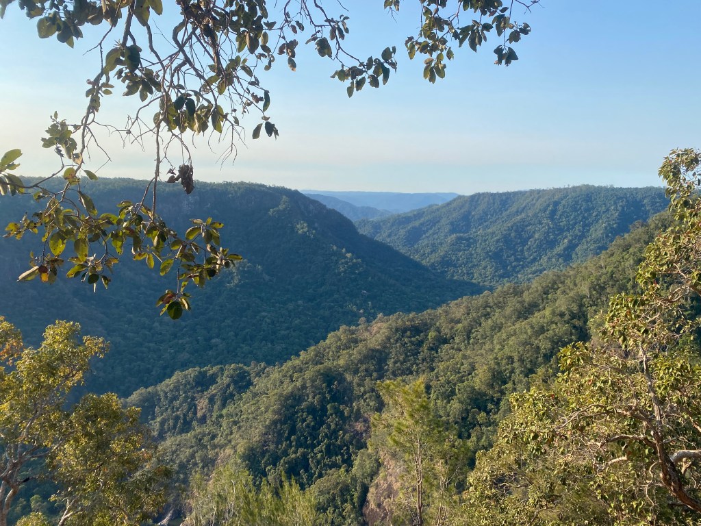
We got up early in the morning as we wanted to hike Tre Cime and see the sunrise. We were visiting in mid-September and it was still very cold in the mornings, the car windscreen was iced over.


Tre Cime di Lavaredo is a 10.1 km hike with stunning mountain views. It was a bit icy and I had a few near slips – we were definitely not very prepared for the conditions and were just wearing trainers, but it worked out okay.
Along the hike are small mountain huts which you can stop in for a coffee and a snack. My partner and I agreed that this is probably our favourite hike we’ve ever done.


We spent the afternoon exploring the town of Cortina d’Ampezzo and relaxing.


.
Day 2 – Cycling Cortina d’Ampezzo to Dobbiaco
- Distance: 60km (4 – 5 hrs)
- Type: Out and back
- Elevation: 653m
- AllTrails: https://www.alltrails.com/trail/italy/veneto/cortina-dobbiaco-run-route-2017
We hired bikes from a Snow Service bike rental in Cortina d’Ampezzo. The bike path was just a few hundred metres away and is a dedicated bike path all the way to Dobbiaco. Hiring the bikes was very easy and there was the option for E-bikes as well.
We saw lots of other riders in some parts, but also had the path to ourselves for most of it. The ride was generally flat but there were some long gradual hills, there were also some fun tunnels along the way.


We stopped at Lago di Landro / Durrensee to have a short rest and take in the view. The lake is so blue it looks like a painting. We arrived in Dobbiaco and stopped for lunch, before making our way back.
Day 3- Adolf Munkel Trail
- Distance: 9.5km (s)
- Type: Loop
- Elevation: 464m
- AllTrails: https://www.alltrails.com/trail/italy/south-tyrol/via-delle-odle-zanser-alm-rifugio-delle-odle-malga-dusler
We were moving locations to Laion and found the Adolf Munkel Trail along the way. A steep but gradual climb to the top, this trail started in the forest before opening up to the mountains with large looming cliff faces.


There were a few huts at the top which serve food and drink, and some friendly rabbits. The largest cliff face is the back view of Seceda, which was exciting to look at the hike we were going to do the next day from a different angle.
Day 4 – Col Raiser – Seceda
- Distance: 10km
- Type: Loop
- Elevation: 553m
- AllTrails: https://www.alltrails.com/trail/italy/south-tyrol/col-raiser-seceda-forcella-pana-rifugio-firenze
This was the hike I was probably the most excited for, as I had seen so many photos online and on social media of the iconic lush green cliff face rising into the sky. The views didn’t disappoint either. We got one cable car to the half way point and then hiked the rest of the way up to build anticipation and get some stunning views along the way.


The guest houses along the way looked like they were out of a fairy tale. This was definitely a hike to remember.
Day 5: Alp di Siusi – Panorama Tour
- Distance: 34.1km
- Type: Point to Point
- Elevation: 717m
- AllTrails: https://www.alltrails.com/trail/italy/south-tyrol/tour-panoramico-alpe-di-siusi-mtb-2
On our final day we were exhausted, but we didn’t want to waste the day! We hired bikes in Ortisei and took a cable car up to begin the ride. Don’t be fooled – even though we took the cable car up, this route was still very steep for bikes as there’s about 700m of elevation gain mostly over the first half of the ride. You can hire E-bikes, which I would recommend if you’re not big on cycling.


The descents were steep and a bit scary as I’m not used to riding gravel. Once you get out of the gravel sections there’s a beautiful ride down into the town to end the ride.
See more on my Instagram here: https://instagram.com/ava_bytrackxtrail
Leave a Reply